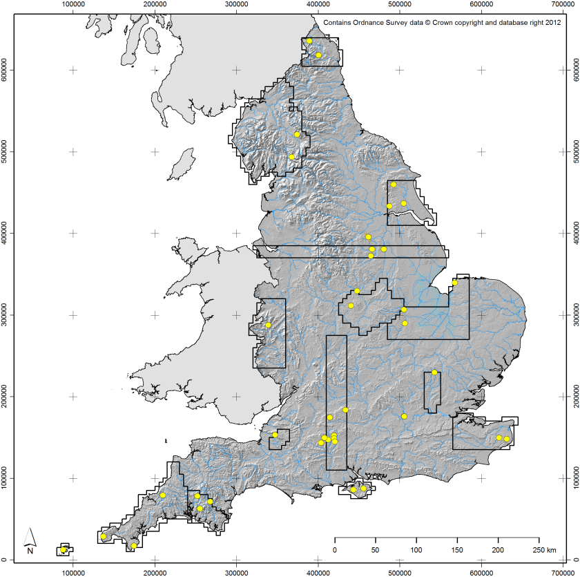
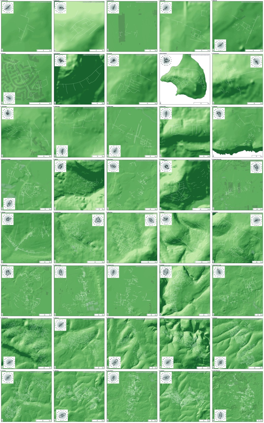
This is another post about field systems, following up on my previous work on the subject (I)(II)(III). As stated in my last post on the subject, I now have a dataset of 40 field systems that I have digitised (based upon NMP data) and subjected to various analyses. Some initial results will be discussed below.
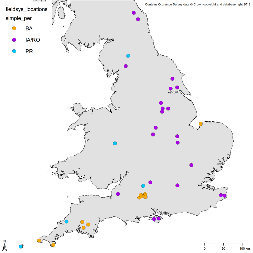
They range in enclosed area from around 2ha to over 1,100ha and cover time periods from the Bronze Age to the Roman period (with a single small section of early medieval reuse in one case). When plotted by time period, the earlier field systems are largely in the south of the country, whereas the Iron Age / Roman ones feature a more comprehensive national spread (the blue “PR” dots represent unspecified prehistoric or possibly Roman field systems):
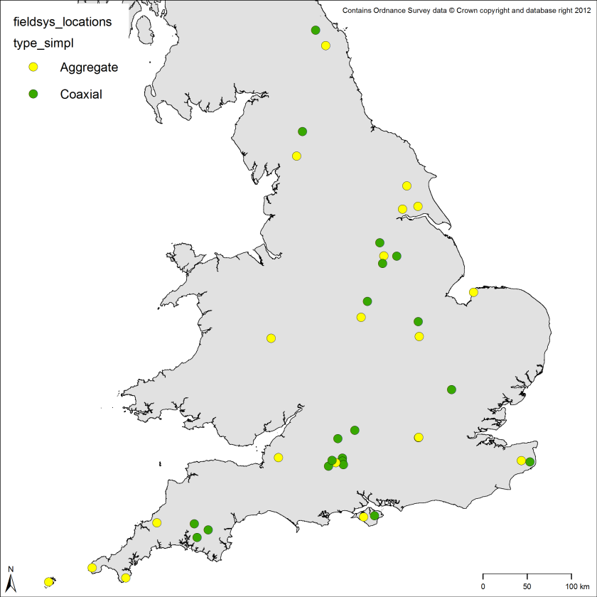
When classified into rough categories of “coaxial” (meaning essentially rectilinear and perpendicular in character) and “aggregate” (meaning more amorphous), both types of field system occur across the country:
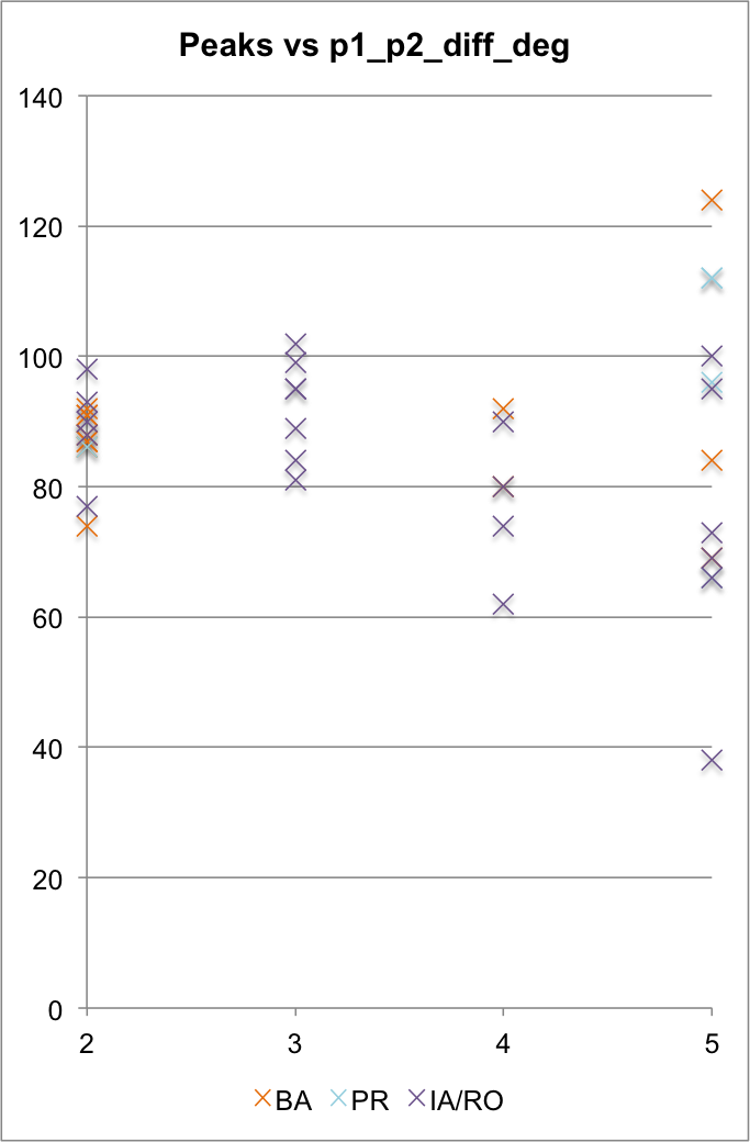
All of these field systems have been subjected to analysis of their morphology, topology (to a limited extent) and landscape character. Probably unsurprisingly, but usefully, field systems with less orientation “peaks” tend towards perpendicularity (y-axis is the difference in degrees between the centres of the first and second peaks on the orientation graphs, the x-axis is the number of peaks on the orientation graphs [5 peaks = 5+ peaks]):
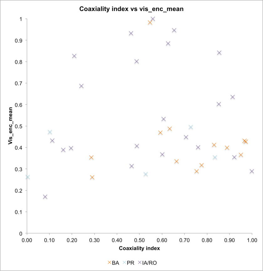
Interestingly, the degree of “coaxialty” of each field system appears to have very little to do with how “open” the landscapes are, which suggests that the layout of field systems (particularly in the Bronze Age) did tend towards “terrain blindness” (x-axis is how “coaxial” each field system was from 0 [not at all] to 1 [very]; y-axis is how visually open the enclosed area of each field system is from 0 [very restricted intervisibility] to 1 [high degree of intervisibility]):
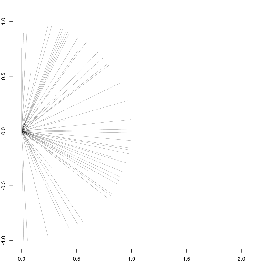
One pattern that has emerged is a degree of bias in orientation towards a particular pair of approximate compass bearings around 100-120˚ and 10-30˚ (this graph shows the direction [and strength] of the two strongest orientation peaks from every field system):
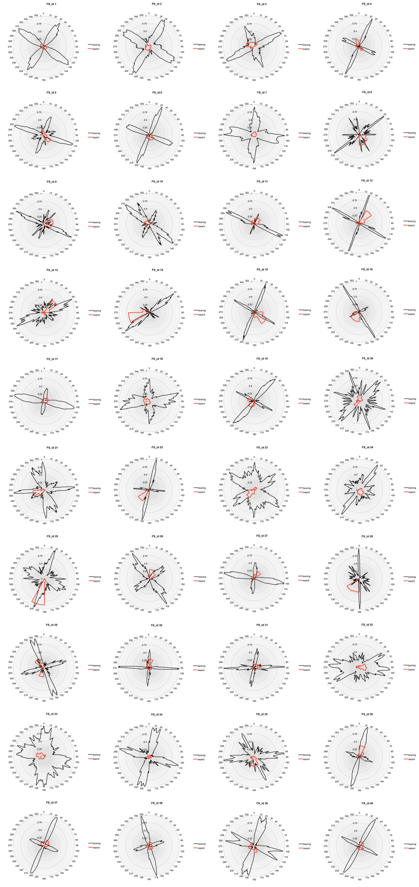
As the graph makes clear, this is not the case across the board, but it is common enough to suggest that there is something going on here. The orientation data was also plotted against the orientation of the aspect of the local terrain, to see if the latter could affect the former (red lines show aspect, black lines field system banks/ditches):
As should hopefully be apparent, the aspect of the ground surface can influence the orientation of field systems (especially in the case of FS_id 25, which runs along the side of a fairly steep hill), but not in many cases.
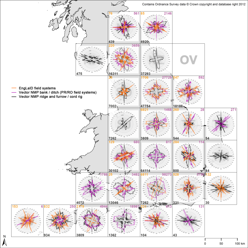
Nationally, these data have been collated by 100x100km OS grid square, alongside orientation data for ridge and furrow, and for unstudied field systems via automated extraction of boundaries. Both of the latter datasets were based purely on the more modern CAD-based NMP projects and processed using automated methods, so the results are based upon more data than my set of field systems, but data that has been less rigorously filtered (numbers record the number of line segments analysed in each square):
The ridge and furrow data shows a particularly interesting pattern here, with a very common bias towards perpendicular orientations just west of north and just north of east for areas north of the Humber. Hall has noticed this pattern before in Yorkshire, suggesting that it probably is the result of a planned reorganisation of the landscape on a large scale at some time before the C13th (2014:53), but my analysis suggests that this may have occurred over a very substantial area of northern England.
So, what we have here is people in prehistory and the Roman period constructing field systems that were sometimes very regular (“coaxial”) in character and sometimes less so, with the ground surface sometimes having an effect on the orientation and regularity of the field systems, but with field systems also often being laid out in a way that ignored the affordances provided by the ground surface. Often, these field systems were laid out on an orientation that pointed approximately towards a compass bearing of 100-120˚ (and at 180˚ to that, as these lines have no direction) and, to a lesser extent, towards approximately perpendicular alignments. When so-called “open field” systems were created from the later early medieval period, these also show an orientation bias (a different one), particularly north of the Humber.
I suppose that the natural inclination of archaeologists working in their respective time periods would be to find a more ritual explanation for the earlier phenomenon and a more pragmatic explanation for the later phenomenon. This in itself is problematic and one of the reasons why working across traditional time period boundaries (as we are) has the potential to produce new interpretations and understandings. For myself, I am not sure what I think (yet)…
Chris Green
References
Hall, D. 2014. The Open Fields of England. Oxford: OUP.

